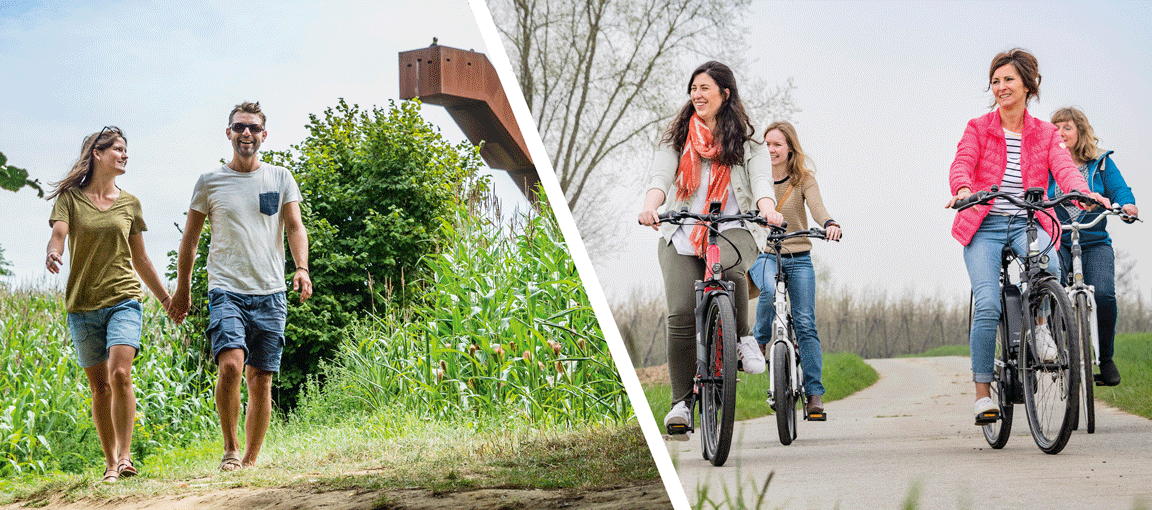
Flemish Brabant has tons of hiking and biking trails, but which ones are the ones locals are most into?

Robin has volunteered to be our guide today. He grew up in Vossem, one of Tervuren's rural sub-municipalities, but didn’t stick around. Instead, he moved to Leuven, so that he could live where he works. On the weekends though he likes to make his way back to his old stomping grounds, where he still keeps quite busy participating in local club and association life.
Check out Robin's favourite walk:
the Walk along the Brabant Loam Plain

FASTCHECK!
- Departure point?
Sint-Lambertuskerk, Neerijsesteenweg/Dorpstraat in Leefdaal (Bertem) - Parking
Across from St. Lambert's Church - GPS coordinates
N 50.847488° E 4.591443° - Distance
13,1 km - Time it takes
2 hours 35 minutes - Paved roads
30 % - Type of terrain
Flat - Signposting
Rectangular signs with red print - Footwear
Mud-resistant - Good eats & drinks
- Frituur Michel next to St. Lambertus Church in Leefdaal (between junctions 5 and 57)
- You’ll find more of a varied selection in the nearby villages of Vossem and Bertem if you’d like to grab a bite to eat or find something to drink:
- Café De Congo in Vossem (Dorpsplein 11, Vossem)
- Restaurant Bertem brug (Kerkstraat 2, Bertem)
WHY
What is it that makes this your favourite walk?
[Robin:] What really does it for me is how authentic the region feels. When you’re on the walk, you really have a sense that you've entered the Brabant of bygone days. The second you escape the centre of Leefdaal, there's hardly a building to be seen and you can just revel in the idyllic countryside. It’s as though time never moved on... and ironically, it’s just a stone's throw away from the hustle and bustle of Brussels and Leuven!
[Robin:] The numerous sunken paths along this walk are also what lend the walk its unique character. Making your way along these deeply etched trails, you go from the River Voer valley, and climb to the Brabant loam plain higher up. From that vantage point, it’s a feast for the eyes with a view that’s absolutely nothing less than gorgeous. From there, you can quite literally see the light at the end of the tunnel!

THE WALK
Could you briefly describe the walk for us?
[Robin:] The square behind Saint Lambert's Church makes for an ideal starting point. A small handful of homes there stand witness to the lovely architecture of days gone by.
Leaving the church, you take a stroll through 'den dreef’ [the lane], flanked on either side by tall, majestic beech trees, and make your way to Leefdaal Castle. The castle itself can’t be visited, but it’s still a lovely sight that's more than worth seeing.
The walking route takes you further east along the waters of the River Voer, and it's here that you're actually treading in the footsteps of the old Dukes of Brabant. From the 11th to the 14th centuries they travelled this path on horseback, on their way from Leuven (the capital of Brabant at the time) to the ducal castle in Tervuren.
By the way, did you know that the city of Tervuren’s name comes from the River Voer? Ter-Voeren’ [On the River Voer].
After having walked for 2 km, you'll find yourself in the tiny hamlet of Sint-Verona, where one of the earliest Roman chapels of Flanders is located. This chapel was built sometime around 900 CE, and legend has it that Saint Verona is buried here. Despite the relative plainness of its architecture, this centuries-old church remains one of my favourites.
From here, the walk becomes an uphill climb, where you gradually make your way up to the Brabant Loam Plain, having left the Voer River Valley behind. Here the route’s setting is an incredible lush green, with fields around as far as the eye can see. From junction 205 onwards, the landscape changes and the route takes you along a few beautiful beechwood forests.
Two farms can be seen in the recesses of a small valley once you’ve made it to junction 206. With just a spot of luck you'll be able to sight some of our world-renowned Brabant draught horses grazing on the slopes.
A trek through the Tersaart forest takes you to junctions 509 and 505, but keep in mind, this whole time you’re still on the plain with its lovely panorama of the Neerijse and Duisburg town centres.
The walk continues in a northerly direction, after which you’ll start your descent via a sunken road leading back towards Leefdaal, having made your way back to the River Voer's waters again. This stream will take you right back to where you started the walk!

FUN FACTS!
Are there any fun anecdotes or intriguing facts that you’d like to share in relation to the Brabant Loam Plain Walk?
The trails along this route always trigger memories of my annual pilgrimage to Scherpenheuvel. Scherpenheuvel is one of Belgium’s most important pilgrimage sites, and every year we walk with a group of mates from our home towns to the Basilica of Our Lady of Scherpenheuvel, which all told is an impressive 43 km (walked in several stages)! All along the way there are people in various villages waiting for us to make our way there and join in on the journey. It’s really great!

PRIMETIME
What's the best time of year to experience the walk at its finest?
[Robin:] Well, it goes without saying that this is a walk you can enjoy year-round. It's gorgeous in the spring when the green starts to sweep out across the landscape. The beechwood forests are at the height of their splendour during the autumn months. In fact, in October you can go chestnut picking between junctions 509 and 505, which is a great activity to do with the kids. On top of that, they’re especially delicious roasted over an open fire!